
Blog
Subdivision Development in Lafayette: A Guide
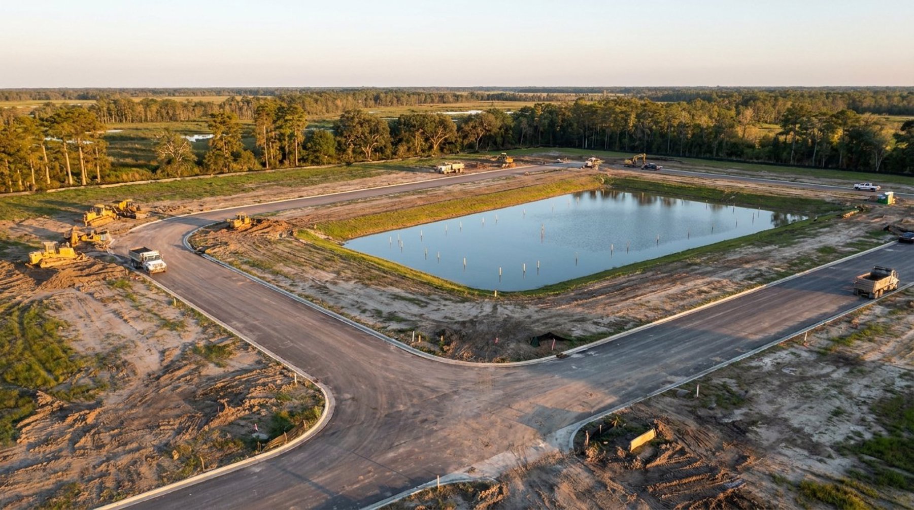
Key Takeaways
- Developing a subdivision in Lafayette Parish follows a defined sequence: due diligence, preliminary plat, civil design, agency approvals, construction, and final plat recordation before lots can be sold.
- Lafayette Consolidated Government (LCG) requires a preliminary plat, drainage study, and infrastructure plans reviewed by its Planning and Engineering departments before any earthwork begins.
- South Louisiana's flat terrain, high water table, and FEMA flood zones make drainage and grading the most schedule-critical part of subdivision engineering.
- Most subdivisions in Acadiana take 12 to 24 months from land acquisition to recorded final plat, depending on size, agency review cycles, and infrastructure scope.
What Is the Subdivision Development Process?
Subdivision development is the regulated process of dividing a parcel of land into multiple buildable lots with the streets, drainage, water, and sewer infrastructure needed to support them. In Lafayette Parish, it moves through six broad phases: due diligence, preliminary plat approval, civil engineering design, agency permitting, construction, and final plat recordation.
You cannot sell individual lots until the final plat is approved and recorded with the parish. Each phase depends on the one before it, so missteps early — an undersized detention pond or an overlooked utility easement — cascade into costly redesigns later. Developers building in Lafayette, Youngsville, and Broussard work with a civil engineering firm early to keep the sequence moving and avoid resubmittals.
Hensgens Trahan Engineering Consulting (HTEC) has guided projects across Acadiana — from standard 60-lot subdivisions to 900-lot master-planned communities like Sugarmill Pond — through every stage of this process.
Step 1: Due Diligence and Feasibility
Before you close on land, due diligence confirms the parcel can actually support the development you envision. This phase evaluates zoning, existing drainage, flood zone designation, utility availability, soil conditions, and access — the factors that determine whether a project pencils out.
A feasibility study answers the critical early questions: How many lots can the site yield? Is any portion in a FEMA Special Flood Hazard Area? Are there wetlands requiring a Section 404 permit from the U.S. Army Corps of Engineers? What will it cost to bring water and sewer to the site? Skipping this step is the single most common reason development budgets blow up after closing.
For raw land in growing corridors like Youngsville and Scott, due diligence also examines topography. A topographic survey maps existing elevations so engineers can estimate cut and fill earthwork — often the largest single line item in a South Louisiana subdivision budget.
Step 2: Preliminary Plat and Conceptual Layout
The preliminary plat is the first formal submittal to Lafayette Consolidated Government and the document that sets your lot count and street network. It shows proposed lots, rights-of-way, drainage servitudes, and utility easements at a conceptual level for review by the Planning Commission.
LCG's Unified Development Code governs minimum lot sizes, street widths, block lengths, and required open space. The engineer balances these requirements against the developer's yield goals — every foot devoted to a wider detention pond or a drainage servitude is a foot not available for a saleable lot. Getting the preliminary plat right protects the project's economics for the rest of its life.
The Planning Commission reviews the preliminary plat at a public meeting and may attach conditions. Approval at this stage authorizes the developer to proceed into detailed civil design — it does not yet permit construction.
Step 3: Civil Engineering Design
Civil design converts the approved layout into the detailed construction plans contractors build from. This is the heart of subdivision engineering and where most of the technical work happens. The plan set typically includes grading, drainage, paving, water distribution, sanitary sewer, and erosion control sheets.
Drainage and Detention
In Acadiana, drainage design drives the entire site plan. Because development replaces absorbent ground with rooftops and pavement, LCG requires a drainage impact analysis proving the project will not increase runoff onto neighboring properties. Engineers size detention ponds to hold the additional stormwater and release it at pre-development rates, then design outfall structures connecting to the parish's drainage network.
Grading and Earthwork
South Louisiana's flat terrain means lots often must be raised above the base flood elevation, requiring imported fill. A cut and fill analysis balances on-site material against imported dirt to minimize hauling costs. On a large subdivision, optimizing the grading plan can save hundreds of thousands of dollars.
Utilities
Plans must coordinate water and sanitary sewer with the serving utility — whether LCG, a water district, or a private system — and confirm adequate capacity and pressure for every lot.
Step 4: Agency Permitting and Approvals
Subdivision construction requires permits from multiple agencies, and these reviews run in parallel but on their own timelines. Coordinating them is one of the most important roles a local civil engineer plays, because a single missing approval can halt the entire project.
Typical approvals for a Lafayette Parish subdivision include:
- LCG Engineering plan approval — review and acceptance of the full construction plan set.
- LPDES construction stormwater permit (SWPPP) — the Louisiana Department of Environmental Quality requires a Storm Water Pollution Prevention Plan for any site disturbing one or more acres.
- Louisiana DOTD permits — required when a subdivision entrance connects to a state highway.
- U.S. Army Corps of Engineers Section 404 — needed if construction impacts jurisdictional wetlands.
- Utility and fire-flow approvals — from the serving water and sewer providers.
Because Acadiana sits in a region rich with wetlands and waterways, environmental permitting frequently appears on the critical path. Identifying wetland impacts during due diligence — not during permitting — keeps the schedule intact.
Step 5: Construction and Construction Staking
Once permits are in hand, the developer's contractor begins building roads, drainage, and utilities according to the approved plans. The civil engineer stays engaged through construction staking, which transfers the design from paper to the ground so the contractor builds in the right place at the right elevation.
Surveyors set stakes marking road centerlines, curb lines, pond grades, and utility inverts. In flat South Louisiana terrain, elevation precision is everything — a pond bottom a few inches off-grade can compromise the detention capacity LCG approved. The engineer also performs periodic inspections and certifies that constructed infrastructure matches the design before the parish accepts it for maintenance.
Step 6: Final Plat and Lot Sales
The final plat is the legally recorded document that creates the individual lots and allows them to be sold or built on. It reflects as-built conditions, dedicates streets and drainage servitudes to the public, and is signed by the engineer, surveyor, and LCG officials before recordation in the parish clerk's office.
Only after the final plat is recorded — and required infrastructure is complete or financially guaranteed — can the developer close on lot sales or pull building permits. At this point the multi-year process delivers its return, and the subdivision is ready for homes or commercial buildings.
How Long Does a Subdivision Take in Lafayette Parish?
Most subdivisions in Lafayette Parish take 12 to 24 months from land acquisition to recorded final plat. Due diligence and design run three to six months, agency review and permitting add three to six months, and construction of infrastructure takes six to twelve months depending on size and weather.
Larger master-planned communities phase their construction, recording final plats in stages so early lots can sell while later phases are still being built. Working with an engineer who knows LCG's review cycles and Acadiana's contractors helps developers build a realistic schedule and avoid the delays that come from resubmittals.
Working With a Local Civil Engineer
Subdivision development rewards local knowledge. An engineer who regularly works with Lafayette Consolidated Government understands the parish's drainage standards, knows which review comments to anticipate, and has relationships with the agencies that issue permits. That familiarity shortens timelines and protects budgets.
If you're planning a residential or commercial development anywhere in Acadiana — Lafayette, Broussard, Youngsville, or beyond — the team at HTEC can guide your project from feasibility through final plat. Call (337) 443-0920 or contact us to discuss your site and map out a realistic path to recorded lots.
What permits do I need for a subdivision in Lafayette Parish?
A subdivision in Lafayette Parish typically requires LCG Engineering plan approval, an LPDES construction stormwater permit (SWPPP) from Louisiana DEQ for sites disturbing one acre or more, utility and fire-flow approvals, and a Louisiana DOTD permit if the entrance connects to a state highway. Projects that impact wetlands also need a U.S. Army Corps of Engineers Section 404 permit.
How long does the subdivision approval process take in Lafayette?
Most subdivisions in Lafayette Parish take 12 to 24 months from land acquisition to recorded final plat. Design and due diligence take three to six months, agency permitting adds three to six months, and infrastructure construction runs six to twelve months depending on the project's size and weather.
What is a preliminary plat?
A preliminary plat is the first formal subdivision submittal to Lafayette Consolidated Government. It shows proposed lots, streets, drainage servitudes, and utility easements at a conceptual level for review by the Planning Commission. Approval authorizes detailed civil design but does not yet permit construction.
Why is drainage so important in South Louisiana subdivisions?
South Louisiana's flat terrain, high water table, and heavy rainfall make stormwater management the most critical part of subdivision design. Lafayette Consolidated Government requires a drainage impact analysis proving a development will not increase runoff onto neighboring properties, and detention ponds must be sized to release stormwater at pre-development rates.